Every Passage Tells a Story
From overnight crossings to quiet anchorages in new harbours — document the passages, crew, weather, and every detail worth keeping. Then share the journey with the people who care.
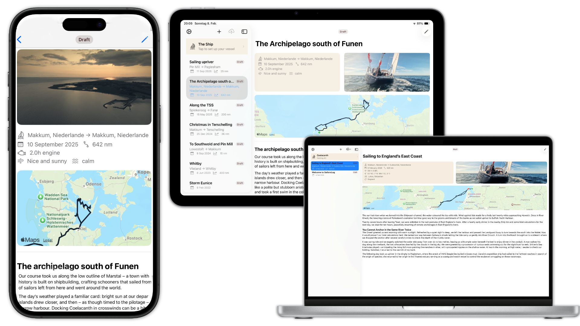
Capture your voyage at sea
Built for Satellite & Sea
Smart sync uploads your log text instantly but holds heavy photos for Wi-Fi. Works perfectly on Starlink, Iridium, or a weak marina signal.
Photo Galleries
Add up to 10 photos per entry. Take photos directly or choose from your library. EXIF GPS data shows photo locations on the map.
Interactive Maps
Relive your voyages with interactive route maps and geo-tagged photos. Import GPX tracks from Navionics, Orca, or your chartplotter to visualize every passage.
GPS Integration
Capture your position with one tap. Auto-fill departure and arrival locations. Track distance, engine hours, and weather conditions.
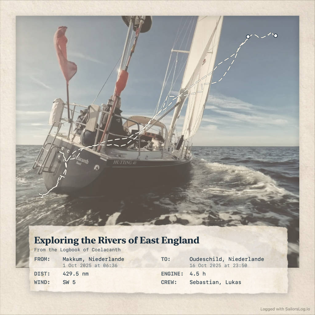
Share Postcards
Create shareable voyage postcards that your crew and family will love. Beautiful compositions with photos, maps, and passage details ready for social media.
Publish Your Sailing Blog Coming Soon
Share your adventures at yourname.sailorslog.io with interactive maps, photo galleries, and beautiful maritime design. One-click publish from the app.
How it works
Create
Write logbook entries offline. Add photos, GPS tracks on maps, weather, and crew.

Remember
Your sailing memories, beautifully preserved with all logbook details.

Share
Inform friends and family about the latest leg of your adventure.
SailorsLog does not aim to be a GPS track recorder or a navigation app.
From the logbook
Exploring the Rivers of East England
We left Texel before dawn, heading west across the North Sea. Southerly winds backing to southeast, Beaufort 5 to 6. Twenty-seven hours later, we picked up a mooring on the River Orwell — the first of four East Anglian rivers we'd explore that week.
Three days upriver, we anchored off Paglesham in the River Crouch: six metres of tide, three knots of current, and somewhere beneath the Essex mud, the wreck of HMS Beagle. We left before the Atlantic depression reached us — 170 miles back to Texel in thirty hours, gusts to fifty knots.
Simple, Transparent Pricing
Free to Start
Perfect for trying SailorsLog
- First 10 entries free
- 1 photo per entry
- GPS integration & GPX maps
- Postcards with watermark
- Single device (no sync)
Skipper
Start your sailing journal.
- Unlimited entries
- Up to 10 photos per entry
- Full CloudKit sync & backup
- Clean postcards (no watermark)
- 2 postcard styles
- Multi-device sync (iPhone, iPad, Mac)
- Export to Markdown
Captain
Publish your sailing blog to the web
- Everything in Skipper
- Web publishing (Coming Soon)
- yourname.sailorslog.io
- Custom subdomain
- SEO & RSS feeds
Start Your Sailing Journal
Start free with your first 10 entries. Upgrade to Skipper (€29/year) for unlimited entries and cloud sync across all your devices.
Download on the App StoreiPhone, iPad, and Mac